Waterfalls in the Smokies adorn most every stream. Only one waterfall, Meigs Falls, is visible from the road. It is 12.9 miles west of the Sugarlands Visitor Center; the pull-off is along Little River Road. All others require hiking, and range from easy to strenuous. Below is a listing of the Smokies’ best known waterfalls:
Laurel Falls is one of the most popular in the park, because it is spectacular! Laurel Falls is 60 feet high, and it the easiest waterfall hike on the Tennessee side of the park. It is 2.5 miles roundtrip through a pine-oak forest and follows a paved trail. The trail cuts through the middle of a series of cascades. The mountain laurel, which is abundant along this trail, blooms in mid May. The trail crosses through Laurel Branch at the base of the upper cascade of the falls. The fall is divided in the middle by the trail and a pleasant pool. The trailhead is located on Little River Road to Fighting Creek Gap, between Sugarlands Visitors Center and Elkmont Campground.
Grotto Falls is off the Roaring Fork Motor Nature Trail. It is 2.4 miles roundtrip though a hemlock dominated forest. This easy trail crosses three small streams and leads behind the falls. The cool moist environment at the falls is perfect for salamanders and summer hikers. The walk is easy, the way broad, and the falls peaceful and refreshing. Though often crowded, Grotto Falls is an excellent stop over in route to Mount LeConte. Large boulders and fallen trees offer plenty of seating. The falls itself is 15 – 20 feet high, usually having a good amount of water coming over. The trail takes you right behind the falls! This is an exciting initiation into the ‘wilderness experience’ for many. Wet rocks are extremely slippery; be very careful. The scenery here is hardwood bottomland, somewhat rocky and rooty, but quite negotiable for even the out of shape hiker.
Beyond the falls, the trail becomes notably steeper as you wind your way up two more miles to Trillium Gap amid the folded shoulders of Mount LeConte. The scenery changes slightly here, as the trees are more sparse and substantially younger. In season (around late April), wildflowers here are unusually profuse and lovely. Occasional panoramic glimpses through the trees will also entice you on. Aside from the flowers, Trillium Gap is hardly a scenic wonder, just a wooded saddle between Mount LeConte and Brushy Mountain, more of a crossroads than a destination: Porter’s Flat is to the east, Brushy Mountain to the north, LeConte to the south and Grotto Falls to the west. Any trip past Trillium Gap should be accompanied by a one-mile jaunt (round trip) up Brushy Mountain. The signs at the gap point the way north on a rocky trail through blueberry, heath and rhododendron bramble. This view is one the best on this side of the Smokies, especially if LeConte is clouded over. At only 4900 feet, it is far less often afflicted by fog.
The flora changes little for about a mile past the gap. However, swags and northern slopes are notably more coniferous. Beyond this, the trees thin out further and the upper elevations offer the familiar Frazer Fir and heath scrub terrain (see Mount LeConte). It is about three and a half miles from the Gap to the lodge atop LeConte. At a mile or so past the gap, you will look up and behold the looming silhouette of LeConte, 1000 feet above you and 2000 feet dead ahead. The last mile of this trail is quite long and not too scenic except when flowering sometime in late May. Press onward! Eventually you will see the wooded apex of High Top just ahead of you.
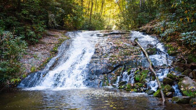
Indian Creek Falls is a 1.5-mile roundtrip hike out of the Deep Creek Area. Sliding down 35 feet of sloping rock strata, the water livens and cools the air. This is an old road trail paralleling Deep Creek. It provides an easy grade and a good walking surface. There are pines, oaks, rhododendron and hemlock, with wildflowers in the wetter places. Along the route is Tom’s Branch Falls, another beautiful fall.
Henwallow Falls is near Cosby Campground, south of Cosby, Tennessee. It is a 4.4 mile roundtrip hike along a moderate trail. This 45-foot fall receives fewer visitations than any other area falls. This makes for a pleasant walk through a hemlock, polar and rhododendron forest to the top of the falls. A side trail leads to the base of the falls in a series of switchbacks. Hen Wallow Creek, only two feet wide at the top of the falls, fans out to a width of twenty feet at the base. This is an easy trail except for a few hundred feet before the falls.
Abrams Falls is a 5-mile roundtrip hike. The trail begins in the back of Cades Cove Loop Road and is a moderate hike. Abrams Falls has the largest water volume of any park fall, and is among the most photogenic. The trail to the falls changes from pine-oak on the ridges to hemlock-rhododendron forest along Abrams Creek. Due to the undertow, swimming in the pool at the base of the falls is very dangerous.
Ramsay Cascades is a strenuous 8-mile roundtrip hike. The highest waterfall in the park. Eastward lies Ramsey Cascade and Greenbrier Pinnacle trails. A leisurely walk along a well-graded roadbed leads to an old parking loop at about one-mile. The trail forks to the two locations. Ramsey Cascade is a famous trail of eight miles leading to a spectacular waterfall. Formally, an invigorating rock climb to the top of the falls yielded an extraordinary view westward. However, deaths and injuries on the cliffs have forced the park service to disassemble the bridge over the river leading to the trail to the top. To ban this gorgeous overlook is unfortunate, however the safety of the park visitors is indeed a paramount issue. Several huge tulip poplars hug the path about midway. The hike is long and tiring, rarely unpopulated, but well worth the effort. In winter, the waterfall is even more beautiful and less crowded. But the trail is sometimes vague under snow, so don’t make a first time of it in the winter months. Local ground squirrels will mooch unceasingly in all months.
Rainbow Falls, at 80 feet, is the highest single plunge waterfall in the park. It is rated between moderate and strenuous. This trail makes a good challenge and reveals a beautiful fall. Imagine hiking 2.7 miles and hearing the gentle sounds of a flowing mountain stream throughout your walk. LeConte Creek is always within hearing distance of the trail to Rainbow Falls. It runs down from Mt. LeConte and into the Little Pigeon River in Gatlinburg. Rainbow Falls is a 75-ft drop. In the wetter months, the waterfall is a beautiful rush of water that cascades over. There is a sitting log at the base of the waterfall that provides a wonderful view.
Mingo Falls can be reached by following the Pigeon Creek Trail out of Mingo Falls Campground (on the Cherokee Reservation, south of the park). A longer side trail branching off at the halfway point will take you to the top of the falls. Mingo Falls has a spectacular drop of about 120 feet.